loading map...
Fast Facts
Country
Chile
Ecuador
Peru
Funding period
01.11.2017 - 28.02.2021
Funding volume
3.896.689 €
Funding reference number
03G0876A-J
Website
SDG Beiträge
Climate action
Icon
Nummer
13
Sustainable cities and communities
Icon
Nummer
11
Partnerships for the goals
Icon
Nummer
17
Download
Contact
Coordinator: Deutsches Zentrum für Luft- und Raumfahrt e.V. (DLR) - Deutsches Fernerkundungsdatenzentrum (DFD) '
Contact Person: Dr. Elisabeth Schöpfer
Address: Münchener Straße 20, 82234 Weßling
Phone@tel
Email: @email
Project partners in Germany
- GRZ German Research Centre for Geosciences, Potsdam
- Alfred Wegener Institute, Helmholtz Centre for Polar and Marine Research, Bremerhaven
- Technical University of Munich, Munich
- 52°North GmbH, Münster
- geomer GmbH, Heidelberg
- EOMAP GmbH & Co. KG, Seefeld
- plan + risk consult, Dortmund
- DIALOGIK gemeinnützige GmbH, Stuttgart
Project partners in Chile, Ecuador and Peru (selection):
Chile:
- Centro de Investigación para la Gestión Integrada del Riesgo de Desastres (CIGIDEN) (Chile)
- Oficina Nacional de Emergencia del Ministerio del Interior (ONEMI)(Chile)
- Servicio Hidrográfico y Oceanográfico de Armada de Chile (SHOA)
Ecuador:
- Instituto Geofísico (IGEPN)
- Instituto de Investigación Geológico y Energético (IIGE)
- Secretaría de Educación Superior Ciencia, Tecnología e Innovación (SENESCYT)
- Servicio Nacional de Gestión de Riesgos y Emergencias (SNGRE)
Peru:
- Centro Nacional de Estimación, Prevención y Reducción del Riesgo de Desastres (CENEPRED)
- Centro Nacional de Planeamiento Estratégico (CEPLAN)
- Centro Peruano-Japonés de Investigaciones Sísmicas y Mitigación de Desastres (CISMID)
- Instituto Geofísico del Perú (IGP)
- Instituto Nacional de Defensa Civil (INDECI)
RIESGOS
RIESGOS - Multi-risk Analysis and Information System Components for the Andean Region
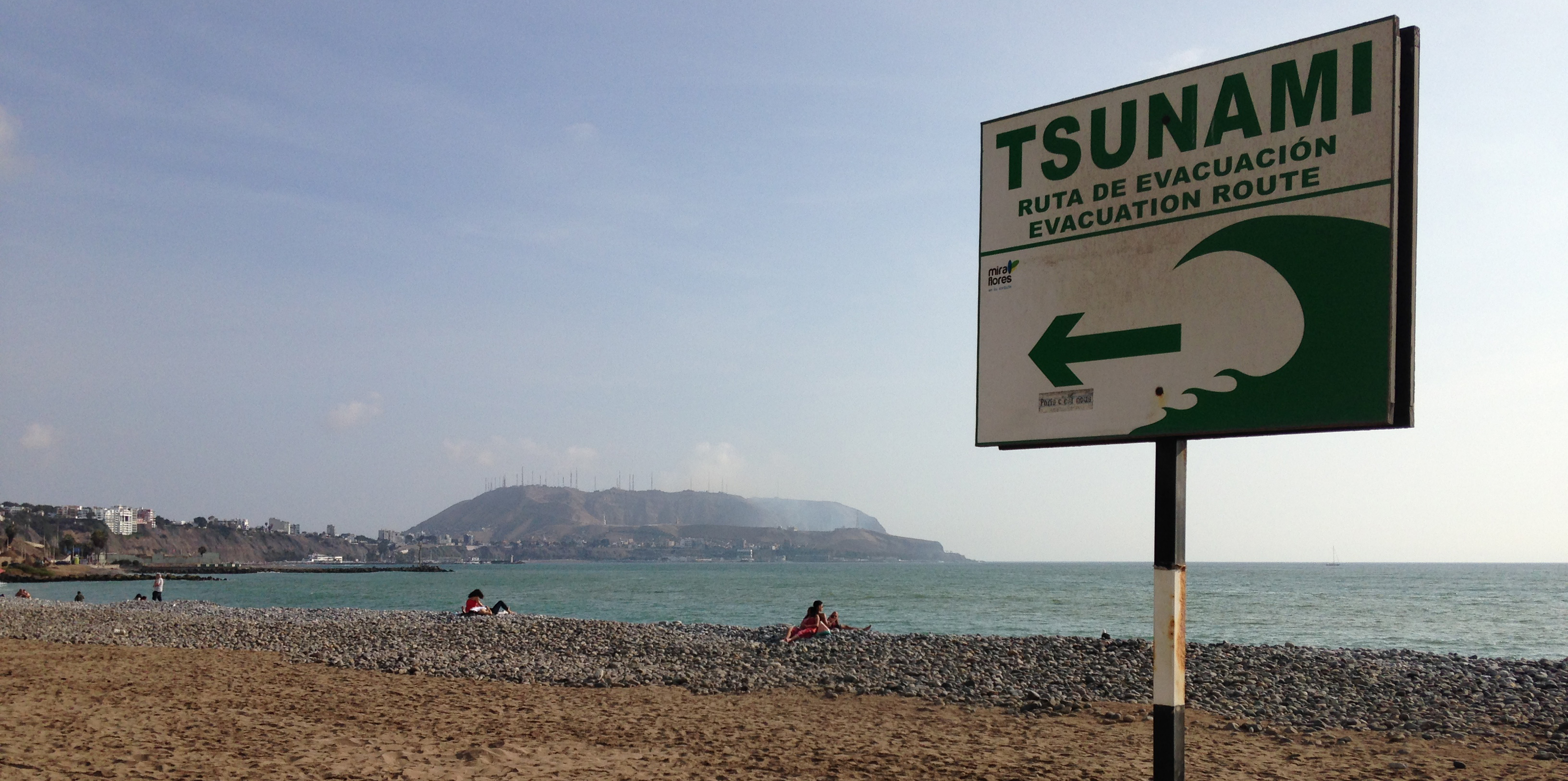
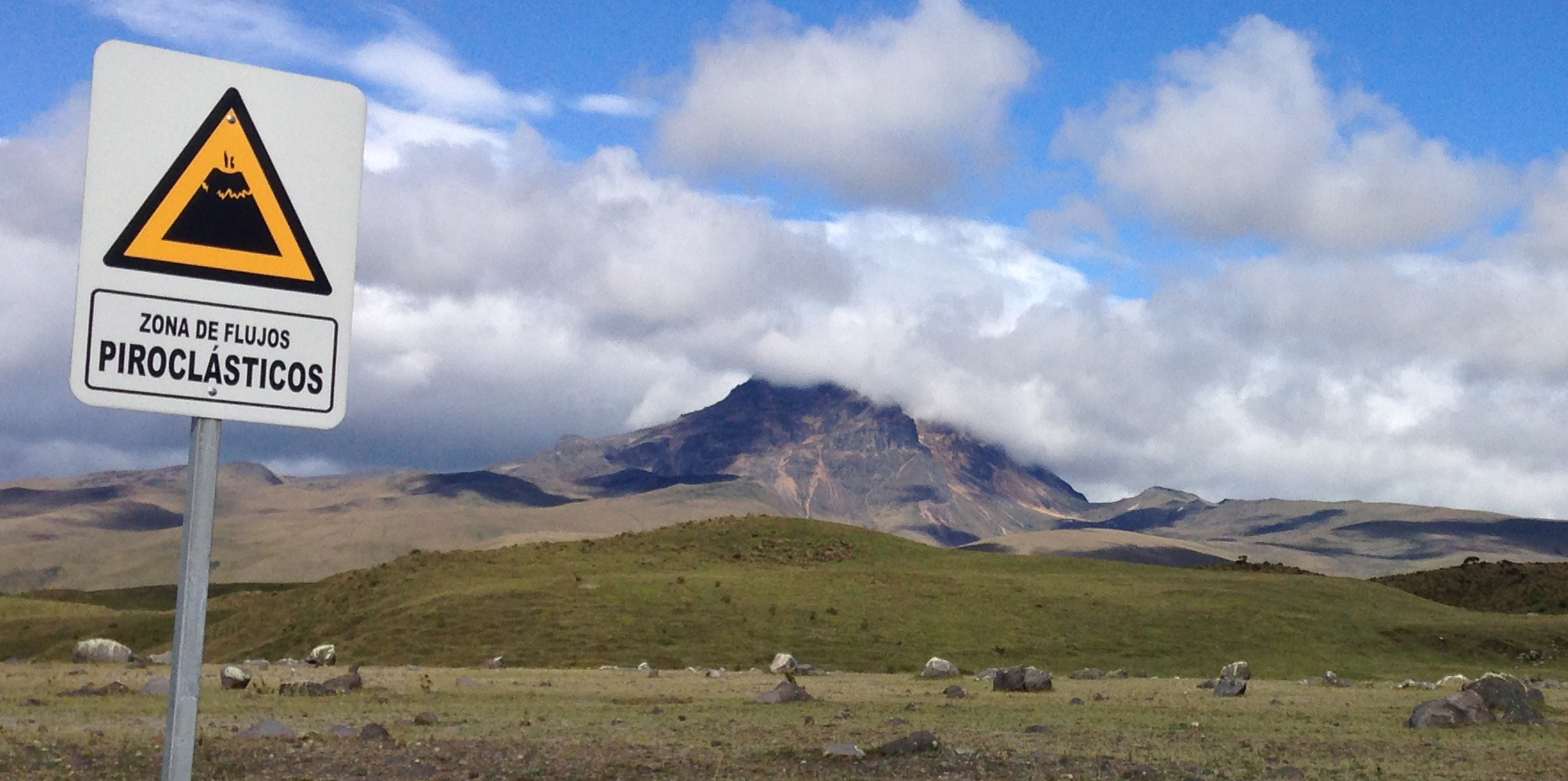
The Andes region is exposed to multiple natural hazards. These often include earthquakes as well as volcanic activity, but also droughts and flood events. The interrelations between natural hazards and cascading effects - for example tsunamis caused by earthquakes - often lead to destructive consequences for society. In the RIESGOS joint project, German, Chilean, Ecuadorian and Peruvian experts from various disciplines are working together to develop scientific methods for assessing complex multi-risk situations. The results will be translated into a demonstrator for a multi-risk information system in the form of web services.
Better understanding of georisks
The close proximity to an active subduction zone causes frequent earthquakes and volcanic activity in the Andean region. In addition, droughts and flood events occur regularly, which are primarily induced by the El Niño phenomenon.
The aim of the RIESGOS project is the development of research methods for the analysis of complex multi-risk situations and associated cascading effects in selected regions in Chile, Ecuador and Peru. The scientific findings and results will be transferred to a demonstrator by the development of corresponding web services, which should be modular and flexibly constructed as a multi-risk information system. This means that the results can be exchanged with cooperation partners in the selected South American Andean countries in a targeted manner. Thanks to the use of recognised standards, their own services can also be integrated into the demonstrator.
The results and developments are to be made available to authorities from disaster risk management and civil protection. They should enable them to analyse complex multi-risk scenarios, reduce risks and improve disaster management.
From the assessment of individual risks to multi-risk assessment
RIESGOS is using approaches from various disciplines such as geophysics, hydrology, geology, geography, geostatistics and remote sensing as well as existing initiatives and services of the South American partners. Different scenarios are being developed for a total of five different natural hazards. These include earthquakes, landslides, volcanoes, floods and tsunamis and their possible interactions. The research in the field of exposure to multiple natural hazards ranges from the analysis of earth observation data to the use of innovative techniques for on-site data acquisition with the aim of developing integrated exposure models. In addition, the analysis of dynamic vulnerability in the context of multiple natural hazards, including structural, social and systemic aspects, should lead to new models with components dependent on time and space. Cascading effects, which significantly increase risk, are identified and probabilistically modelled.
Developing a demonstrator for a multi-risk information system is one of the main goals of the project. A modular system concept will be developed and created in close cooperation with the South American project partners. Central elements of the RIESGOS information system concept are web-based services that enable open and flexible access to decentralised data and computing services. The demonstrator should have the ability to purposefully combine and manage the individual web services so that a future user of the demonstrator can independently explore and evaluate different multi-risk scenarios. A key element of the added value of this modular and interoperable approach is the ability to integrate different web services into existing system environments.
In order to better understand, describe and quantify multi-risk situations, RIESGOS is working with case studies in selected pilot regions in Chile, Ecuador and Peru. These represent realistic multi-risk situations including cascading effects. Earthquakes, tsunami and critical infrastructure are being investigated in the region of Valparaíso as well as in Greater Lima. In Quito and the Cotopaxi region, the focus is on lahars, landslides, flooding and critical infrastructure.
For practical application
The RIESGO approach is geared to the needs of potential users and practicality. Close contact with national and local authorities and public disaster risk management organisations will be maintained throughout the project to ensure that users' needs and feedback on interim results are recorded and integrated in the best possible way throughout the development process.
The development of the demonstrator will be complemented by initiatives from the German consortium and the South American partners, who will evaluate and test the applicability for spatial planning and for risk communication with actors from science, politics, administration, economy and civil society.
RIESGOS will also analyse the potential for the possible economic exploitation of the services developed.
Publications
Events
RIESGOS demonstrator and web services in open source
Image

The source code of the RIESGOS demonstrator is now available on GitHub, a platform for creating and managing collaborative and free software.