
RAIN: Student theses support our work in Ghana
Since the start of the BMBF-funded joint project RAIN, three students have already completed their final theses within this project. The content of the theses dealt with the development of water balance models for rural and urban regions in Ghana, as well as a methodological evaluation of Ghana's national and local water management plans. Due to the project-related questions, the results of the work were profitably integrated into the current and upcoming project work.
The first bachelor thesis dealt with the development of a water balance model for urban and rural water catchment areas in Ghana. In cooperation with the Institute for Urban Water Management ISA (RWTH Aachen University), The student investigated a selection of modelling programs with regard to their applicability for a continuous water balance model in Ghana. Subsequently, a water balance model for the metropolitan region of Accras was created with the help of HEC-HMS. This was done conceptually on the basis of assumptions, since at this point in time the data collection phase as well as the concrete selection of the pilot regions of the project had not yet been completed. The created reference model served as a basis for a sensitivity analysis of the parameter values, which was used to investigate the extent to which HEC-HMS is suitable for differentiating the water balance in urban and rural regions.
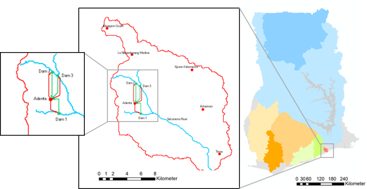
Building on earlier mentioned final thesis, a different student examined the chances and limits of model adaptation using the example of a water balance model in Accra. This was done in cooperation with the FH Aachen, Department of Civil Engineering. On the basis of the previously gained knowledge regarding the program HEC-HMS and a further research regarding the advantages and disadvantages of different modeling programs, the water balance model was created here with the program SWAT. The water catchment area of the Sakumono Lagoon, which has now been determined as one of the two pilot regions, was used as the basis for the modeling. Special attention was paid to the dependence of the model quality on the data basis. As an additional product, Simon Ludwig used remote sensing data to generate high-resolution land use data in the centimeter range, which distinguishes paved building and traffic areas from green spaces. The green spaces were then differentiated into different segments by intersecting them with other land use data.
In addition to the development of a water balance model, a further goal of the joint project RAIN is to develop adapted water management plans for urban and rural settlement areas, which take into account not only the quantity but also the water quality. Another bachelor thesis dealt more closely with the evaluation of methods for the model-based integration of local measures in regional and national water management plans in Ghana. The student evaluated the possibilities of integrating water quality in water reservoirs using the software WEAP and then assessed the possibility of implementing measures to improve water quality in rainwater retention areas. This thesis was also written in cooperation with the Institute for Urban Water Management ISA of the RWTH Aachen University.
More information about the project under https://www.bmbf-rain.com/.
