
Better understanding of georisks - focus on the Andes
In order to better understand and predict disaster interactions, the German Aerospace Center (DLR) and its project partners are developing a multi-risk information system: The "RIESGOS" (Spanish for "risks") project aims to provide information bases for improving the management of natural disasters and developing strategies for preventing or mitigating risks. Using web-based application services, decision-makers and other players should be able to create future risk analyses for the overall situation and to simulate scenarios with complex risk chains. Previous risk information systems usually only consider individual components. A novel system is now being developed as a prototype for the Andean region in Chile, Peru and Ecuador, which is particularly vulnerable to natural disasters.
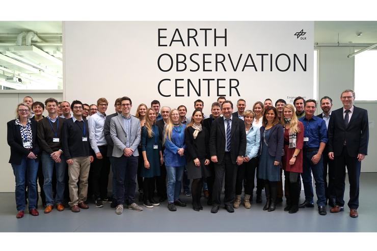
"Over the next three years, we will explore the dangers which could be created by natural disasters and develop scientific methods to assess the various risks. I am looking forward to gaining an overall picture from the details of the individual departments. This will allow us to make an important contribution to minimising the risk of natural hazards to society. This will drive research work beyond the project, explains RIESGOS project manager Dr. Elisabeth Schöpfer from the German Remote Sensing Data Center of the DLR. Around 40 national and international research institutions, authorities and companies are bundling their expertise for this purpose. The project is funded by the Federal Ministry of Education and Research. RIESGOS was inaugurated on December 7, 2017 with a kick-off meeting at the DLR in Oberpfaffenhofen.
Innovation and value creation
The dangers do not only affect each other, but also have cascading effects, meaning chain reactions can occur. The Andes region, which is at high risk of natural disasters due to its geographical location, is particularly affected by this.
International cooperation is essential in order to improve risk minimisation processes and prevent possible impacts of future natural disasters. In addition, RIESGOS will help to better understand and develop understanding of the complex relationships between physical phenomena and social and economic systems. This will allow us to increase the effectiveness of risk-mitigation measures and strategies. As an excellence research centre funded by the Comisión Nacional de Investigación Científica y Tecnológica, CIGIDEN is proud to be involved in this international collaboration according to Rodrigo Cienfuegos, Director of the Research Center for Integrated Disaster Risk Management (CIGIDEN) and associate professor at the Pontificia Universidad Católica de Chile.
In order to answer the question: "What happens if ...", the RIESGOS project teams are developing scenarios of flood situations, landslides, volcanic activity, earthquakes, tsunamis and their mutual interactions. Scientists from various disciplines are using a wide range of data, including high-resolution optical remote sensing data and radar data, to extend local research areas to regional and national levels.
"Only through long-term, interdisciplinary cooperation between different specialist groups in Germany and South America can we ensure that we can better understand and limit the impact of natural extreme events on society. For example, through sustainable land management and far-sighted urban planning which reflects understanding of the vulnerabilities and risk and gives them proper consideration", says Prof. Stefan Dech, Director of the German Remote Sensing Data Center of the DLR.
The work in Germany is carried out in close cooperation with the South American partners. Their experience in dealing with natural disasters is central to the needs and practice orientation of RIESGOS. The project therefore does not focus solely on the development of innovative technical system components and web services. There are also application potentials for the German and South American market. Services based on RIESGOS multi-risk analyses are meant expand the value chain of the research and development project in the future.
About the project
RIESGOS is funded by the Federal Ministry of Education and Research (BMBF) within the framework of the funding measure "BMBF CLIENT II - International Partnerships for Sustainable Innovation" of the "Research for Sustainable Development (FONA3)" research project. Project Management Jülich is looking after the project in a technical and administrative capacity on behalf of the Federal Ministry of Research.
The RIESGOS project consortium consists of the following academic research institutions and industrial partners: The German Aerospace Center, German Research Center for Geosciences, Alfred Wegener Institute, Technical University of Munich, 52°North, geomer GmbH, EOMAP GmbH & Co. KG, plan + risk consult, DIALOGIK. The following associated partners are supporting the project: GIZ, UNOOSA / UN-SPIDER, UNESCO and MunichRE. RIESGOS is cooperating with more than 25 research partners and authorities in the South American partner countries of Chile, Ecuador and Peru and plans to expand this cooperation throughout the course of the project.
This article was published online in our catalogue on December 7, 2017. We publish the text here by courtesy of the German Aerospace Center (DLR).
